
| SDSS Classic |
| SDSS.org |
| SDSS4.org |
| SDSS3.org |
| SDSS Data |
| DR19 |
| DR17 |
| DR10 |
| DR7 |
| Science |
| Press Releases |
| Education |
| Image Gallery |
| Legacy Survey |
| SEGUE |
| Supernova Survey |
| Collaboration |
| Publications |
| Contact Us |
| Search |

| Observing Operations | Reviews | Survey Management |
Survey Operations
Welcome to the SDSS Survey Operations homepage. To see our observing progress, click on the following links. The visual images show the amount of sky that we plan to survey, as well as the area that we've covered to date. The graphs show the amount of data acquired to date against our baseline performance plan. The baseline performance plan and full set of progress graphs can be found here.
| Legacy Survey | |
| Imaging Operations: |
Survey
area scanned to date Cumulative imaging vs. baseline: Northern Survey Cumulative imaging vs. baseline: Southern Survey Cumulative imaging vs. baseline: Southern Equatorial Survey |
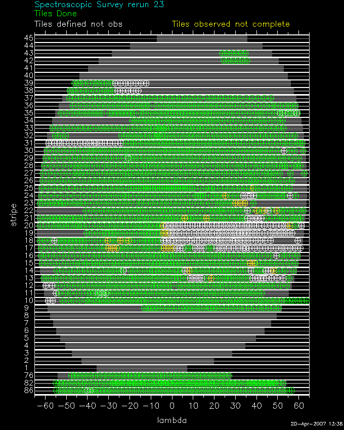
| Spectroscopic Operations: |
Survey
area tiled to date Cumulative spectroscopy vs. baseline: Northern Survey Cumulative spectroscopy vs. baseline: Southern Survey Cumulative spectroscopy vs. baseline: Southern Equatorial Survey |
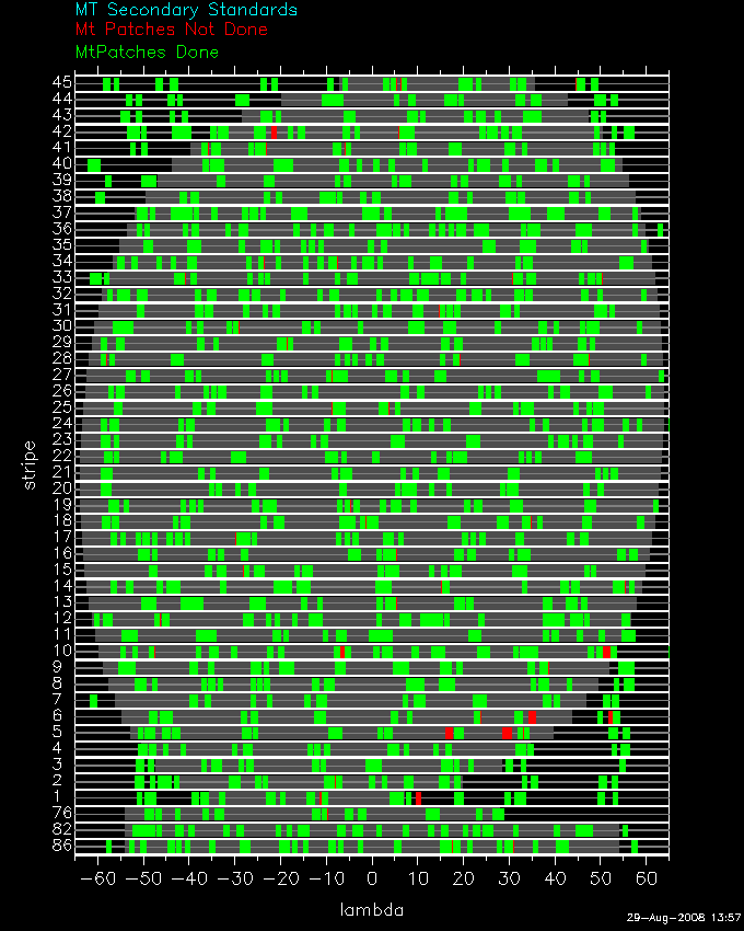
| Photometric Calibration Patches: | Secondary patch coverage to date |
| SEGUE Survey | |
| Imaging Operations: | Cumulative imaging vs. baseline |
|
Spectroscopic Operations: |
Cumulative spectroscopy vs. baseline |
| Performance Summaries | |
| Tabulated Progress Summaries: |
Imaging history to
date, by quarter Imaging history to date, by dark run Spectroscopic history to date, by dark run |
| Observing Performance: | Observing performance metrics |